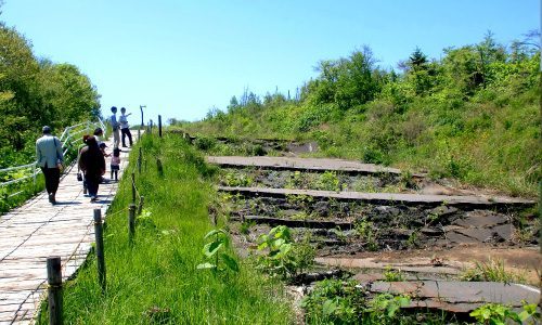
Going around the volcanic craters in human habitation and roadways.
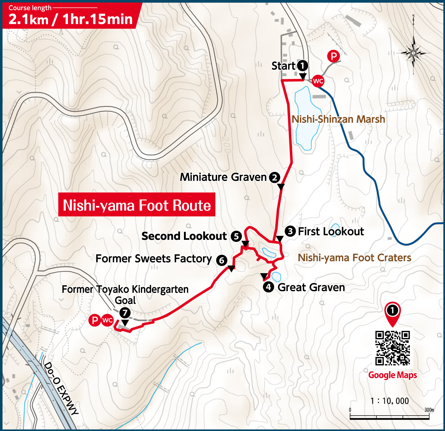
Open: Late April through mid-November
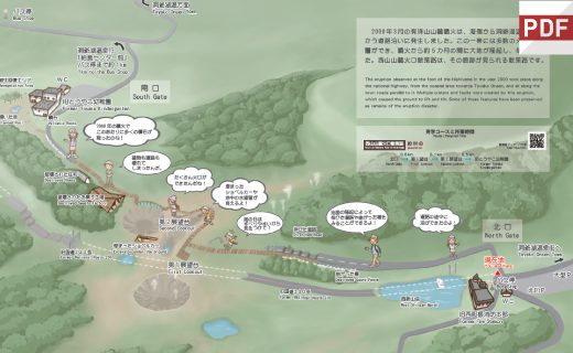
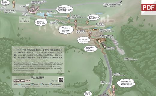
This route passes through the remainder of the eruption that extended across National Route 230 and the lined up railroad ties. The course will help you feel the power of an eruption in an inhabited area by letting you see the ponds created in the middle of the highway, the elevated asphalt, the heavy machinery that was left behind, and more.